The Langdale Pikes via Bright Beck
A quality mountain day - The Langdale Pikes via Bright Beck

Sometimes the best days in the mountains come from things not going quite to plan.
We’d set off from the Stickle Barn in Langdale, intending to climb Pavey Ark via the superb scramble, Jack’s Rake. The path took us up the east side of Stickle Ghyll and we played around with some linear navigation along the way. We swung away from the main path at the point where it crosses Tarn Crag Ghyll, zig-zagging up the bracken-covered flanks to gain a flat area by on old stone-walled enclosure to the east of Tarn Crag itself. Our plan was to head north to pick up the path coming off Blea Rigg, then walk around the eastern shore of Stickle Tarn to gain the scree slope that leads up to the imposing crags of Pavey Ark, where we’d find the start of Jack’s Rake.
It had been a very wet few days prior to our walk and the becks were all swollen with white water. The ground up around Blea Rigg was boggy and black with wet peat. But the sun shone from above, and it was an energising feeling heading for the heights on such a good day.
As we skirted around the east side of Stickle Tarn I began to worry that the little stream coming down from the bowl between Pavey Ark and Sergeant Man might prove challenging to cross. This stream is Bright Beck. Usually there’s a boggy little section just before you cross the stream (I once fell head first into this quagmire, much to the delight of my clients who were following!), then the stream itself is just a short paddle and boulder hop and you’re over, and making your way towards Jack’s Rake.
Not so today. Bright Beck was dangerously high. I have a very general rule that if the water is flowing faster than I can comfortably walk, it’s too dangerous to cross. Today it was thundering down out of the cirque, and would have easily swept us off our feet. So, what were we going to do? Initially we thought we might just be able to cross by going a little further upstream. We followed the east side of Bright Beck, looking longingly at Pavey Ark rising above the west bank. Smaller side streams came in to join Bright Beck, but these were easy enough to cross, the only problem being that there were very many more of them on the ground than were shown on our map.

We used ‘half bearings’ to check the direction of flow on the streams to keep a track of where we were without having to pace or time to measure distance. One of these streams gave us a great little climb, passing what the OS map shows to be a tiny pond, but which is actually an old sheep fold, to eventually gain the high southern flanks of Sergeant Man. Sergeant Man's little summit is a great place to enjoy the views of all the surround fells, and we soon left there to head for the top of High Raise, a summit often described as the ‘hub’ of the Lake District.
Southwards from High Raise there’s an expanse of open moorland dipping to a broad, grassy col, then rising onwards to Thunacar Knott. This and the region just south of Thunacar Knott is a great place to practice navigation, offering lots of small but distinct features such as pools, spurs, re-entrants, crags, and boulders, and we played around here a while, then decided not to miss out on Pavey Ark’s lovely summit after all.
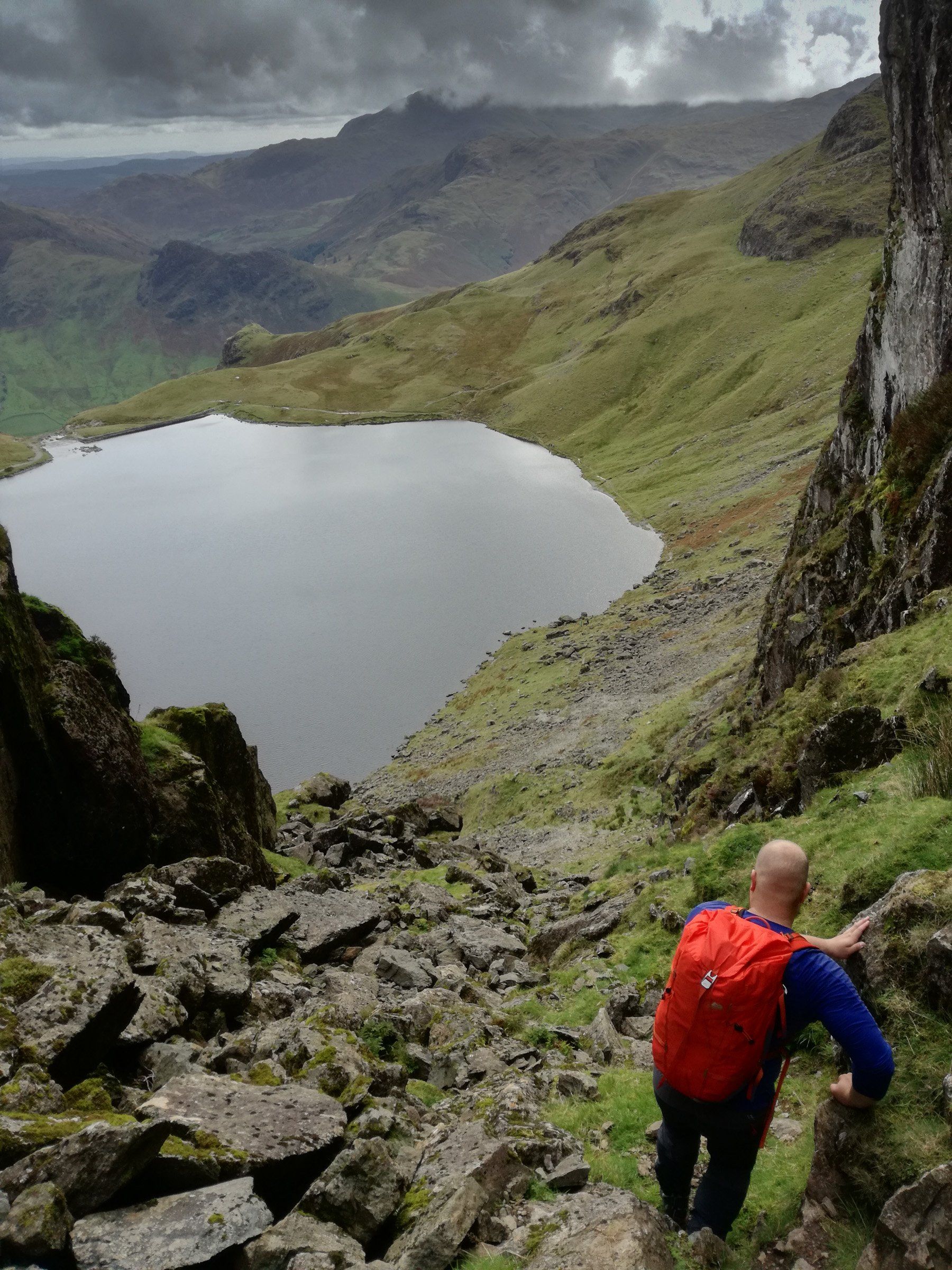
We’d seen few other walkers all day, despite the fabulous weather, so it was nice to have a chat with a couple and their dogs on the summit of Pavey Ark. From the summit there’s rough and rocky ground leading northwards for a short way to pick up the path down to Bright Beck to the east. We descended a short way, then found the obvious notch that forms the top of Easy Gully.
Just below this notch, heading down the gully, the way seems blocked by a massive boulder choke. We started on the right, looking down and took an easy step down to the left, then moved back to the right immediately. Here there’s an exposed cleft that takes you down to a slab guarded by a huge boulder. We carefully slithered down the slab, then scrambled carefully down the gully itself. At the bottom we looked up at Jack’s Rake, rising diagonally across the face. An easy walk around the west side of Stickle Tarn, to avoid having to try crossing Bright Beck on the east side, and just a pleasant walk down the side of Stickle Ghyll took us back to the car park in Langdale.
A superb day out on the Langdale Pikes, but certainly not the day we’d planned!
Start Point:
Stickle Barn Tavarn. Grid ref: NY294064.
Map:
OS Explorer OL6
Distance:
10km
What made this a QMD?
Good weather. Being flexible with regards to route and planning. Practicing navigation. Enjoying a scramble. Great mountain scenery. Three mountains climbed.
Join me for your Mountain Leader training or assessment course. Full details of the Mountain Training courses we provide here.


Proud to be supported by: